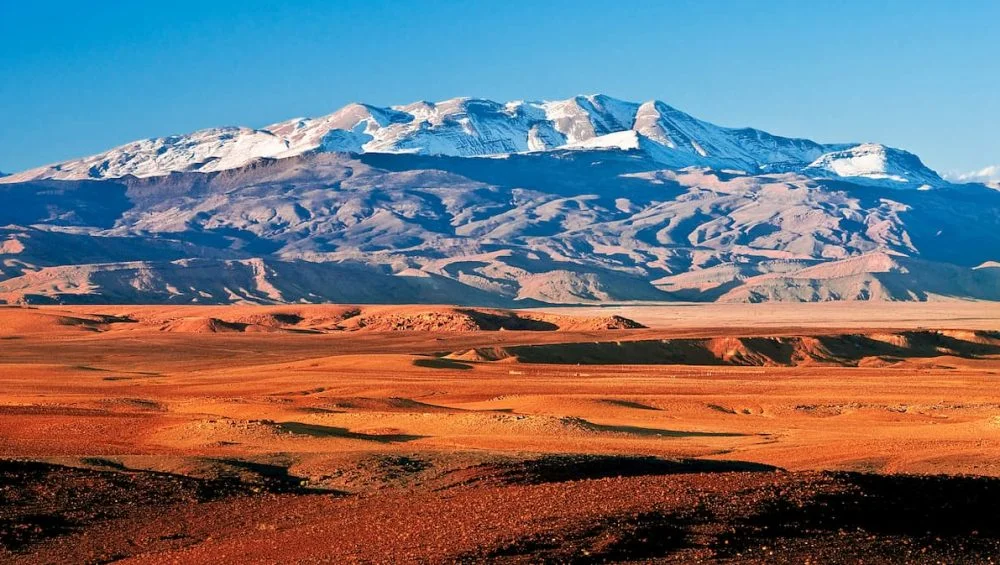
The Atlas Mountains are among the most spectacular mountain ranges in North Africa, offering dramatic landscapes, traditional villages, high-altitude trails, and unforgettable hiking experiences. Stretching across Morocco, Algeria, and Tunisia, the range includes a variety of environments, from dry foothills and green valleys to rugged peaks covered with snow during winter.
For hikers, understanding the geography and location of different mountain areas is essential for choosing suitable routes and planning a safe adventure.
A reliable map of the Atlas Mountains in Africa helps hikers understand the relationship between mountain ranges, valleys, villages, trailheads, and major peaks. Whether you are planning a short day hike or a challenging multi-day trek, studying the geography before arriving can make your journey more organized and enjoyable.
Understanding the Atlas Mountain Range
The Atlas Mountains are not one continuous ridge with identical terrain. Instead, they consist of several major ranges with different elevations, landscapes, and hiking conditions. The High Atlas, Middle Atlas, Anti-Atlas, and Tell Atlas are among the most important sections to understand when planning an adventure.
Morocco contains some of the most famous hiking areas, particularly within the High Atlas. The mountains gradually change from lower, dry landscapes to steep alpine terrain. This geographical diversity means hikers can find routes suitable for different experience levels.
When examining a map of the Atlas Mountains in africa, pay attention to the position of major mountain ranges and the communities located around them. These details can help you identify transportation options, accommodation areas, trailheads, and potential trekking routes.
The High Atlas: A Hiker’s Favorite
The High Atlas is particularly popular among hiking enthusiasts because it contains some of North Africa’s highest peaks. Mount Toubkal is the most famous summit and reaches approximately 4,167 meters above sea level. The surrounding area offers numerous trails through valleys, rocky slopes, and Berber villages.
The village of Imlil is one of the best-known starting points for Toubkal-related treks. From Imlil, hikers can follow trails toward mountain refuges and eventually continue toward the summit. The scenery changes dramatically along the way, providing views of terraced fields, deep valleys, and rugged peaks.
A detailed map of the atlas mountains in africa can help hikers distinguish the main Toubkal routes from other trails in the region. It can also help with estimating distances between villages and understanding how elevation changes throughout a trek.
Middle Atlas Hiking Opportunities
The Middle Atlas offers a different experience from the High Atlas. Its landscapes include forests, plateaus, limestone formations, springs, and deep valleys. Cedar forests are particularly characteristic of parts of this region, creating a greener environment than many areas farther south.
Hikers interested in nature and wildlife may enjoy exploring trails around the Middle Atlas. The region also provides opportunities for travelers who prefer moderate hikes rather than extremely high-altitude summit attempts.
Because the terrain can vary significantly, hikers should study trail information carefully before setting out. A geographical map can provide an overview, but detailed trail maps and local guidance are valuable for identifying actual hiking paths.
Exploring the Anti-Atlas
The Anti-Atlas lies farther south and is known for its rugged scenery, rocky valleys, unusual geological formations, and dry landscapes. It offers a quieter alternative to some of the busier trekking destinations in the High Atlas.
Hiking in the Anti-Atlas can involve walking through remote valleys and mountainous terrain where services are limited. Travelers should therefore plan carefully, carry sufficient water, and understand local weather conditions.
Looking at a map of the Atlas Mountains before visiting the Anti-Atlas can help hikers understand how this southern range relates to Morocco’s other mountain regions. This is especially useful when planning longer journeys that combine several destinations.
Important Features to Look for on a Hiking Map
Not every map provides the same level of information. Hiking enthusiasts should look for maps showing elevation contours, mountain passes, rivers, villages, roads, trailheads, and established trekking routes.
Contour lines are particularly useful because they indicate changes in elevation. Lines positioned closely together usually represent steeper terrain, while wider spacing generally indicates gentler slopes.
Maps should also identify important landmarks. A village can serve as a starting point or overnight location, while a mountain pass may represent a difficult section of a route. Rivers and valleys can also influence the direction and difficulty of trails.
Digital mapping applications can be useful for navigation, but hikers should not depend entirely on smartphones. Remote mountain areas may have limited mobile coverage, and batteries can run out. Carrying an offline map or physical backup is a wise precaution.
Planning Routes and Understanding Elevation
Elevation is one of the most important factors when planning an Atlas Mountains hike. A route that looks short on a map can still be physically demanding if it involves substantial elevation gain.
For example, a relatively short distance between two points may require several hours of climbing over rocky terrain. Hikers should therefore consider distance, elevation gain, altitude, weather, and fitness level together.
Altitude can also affect visitors who are not accustomed to high elevations. Gradual acclimatization, proper hydration, reasonable pacing, and awareness of altitude-related symptoms are important for higher mountain routes.
Navigation and Trail Safety
Atlas Mountain trails can range from clearly established paths to rough routes through remote terrain. Local guides can be especially valuable for longer treks or less-developed routes. They can provide information about changing weather, trail conditions, water sources, and local customs.
Before leaving for a hike, share your planned route with someone and check the expected weather. Mountain weather can change quickly, particularly at higher elevations. Appropriate footwear, layered clothing, sun protection, food, water, navigation equipment, and emergency supplies should be selected according to the route.
A map of the Atlas Mountains should be considered a planning tool rather than a replacement for local knowledge. Combining maps with reliable trail information and experienced guidance can significantly improve the hiking experience.
Best Seasons for Atlas Mountain Hiking
The ideal hiking season depends on the region and altitude. Spring and autumn are often attractive periods for many Moroccan mountain treks because temperatures can be more comfortable than during the hottest summer months.
Summer can be suitable for some high-altitude routes, although lower valleys may become very hot. Winter brings snow and colder conditions to higher elevations, creating a more demanding environment that may require appropriate equipment and mountaineering experience.
Checking seasonal conditions before traveling is essential because snow, rainfall, heat, and trail conditions can influence route accessibility.
Preparing for an Unforgettable Adventure
Good preparation allows hikers to enjoy the Atlas Mountains without unnecessary difficulties. Study your intended route, understand the elevation profile, identify accommodation or camping options, and determine where food and water will be available.
It is also worth learning a few basic phrases in the local language and respecting the traditions of mountain communities. Many hiking routes pass through villages where residents maintain long-established cultural practices. Responsible tourism means respecting private property, local customs, wildlife, and the natural environment.
For route planning and trekking support, mttoubkaltrek can be a useful resource for travelers interested in discovering Morocco’s mountain landscapes. From understanding trekking areas to preparing for mountain adventures, choosing knowledgeable local support can make the experience more comfortable and memorable.
Conclusion
The Atlas Mountains provide an extraordinary variety of hiking experiences, from accessible valley walks to challenging high-altitude adventures. Understanding the geography is one of the first steps toward selecting the right route and preparing properly. By studying a map of the Atlas Mountains in africa, hikers can identify major ranges, understand elevation changes, locate important villages, and create a more practical itinerary.
With careful planning, suitable equipment, reliable navigation, and respect for local communities and nature, the Atlas Mountains can offer an unforgettable adventure for hiking enthusiasts. Whether exploring the famous High Atlas or seeking quieter trails in the Middle Atlas and Anti-Atlas, preparation and geographical awareness will help you make the most of every step.